 |
Interesting Information About
Mohave County, Arizona |
|
|
|
Mohave County is in the northwestern corner of the U.S. state of Arizona. As of the 2010 census, its population was 200,186. The county seat is Kingman, and the largest city is Lake Havasu City.
The county was named after the Mohave tribe, who are indigenous to the area. The area that is now Mohave County has a rich history dating back to prehistoric times. The Mohave tribe has lived in the area for thousands of years, and their descendants still reside in the region today. Spanish explorers arrived in the area in the 16th century, and the region was later settled by Americans in the mid-19th century. Mohave County was officially established in 1864, shortly after the end of the American Civil War.
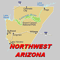
It is the fifth largest county in the United States. The county consists of two sections divided by the Grand Canyon, with no direct land communication between them. The northern section, smaller and less populated, forms the western part of the Arizona Strip, bordering Utah and Nevada. The Arizona Strip is the part of Arizona lying north of the Colorado River.
The difficulty of crossing the Grand Canyon causes this region to have more physical and cultural connections with southern Utah and Nevada than with the rest of Arizona. The largest settlements in the Strip are Colorado City, Fredonia and Beaver Dam with its surrounding communities of Scenic, Littlefield and Desert Springs.
The larger southern section borders Nevada and California across the Colorado River, which forms most of the county's western boundary. The southern section includes Kingman, the county seat, and other cities, as well as part of the Mojave Desert.
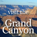
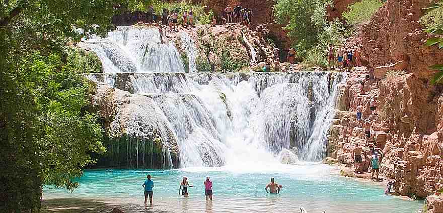
Mohave County contains parts of Grand Canyon National Park and Lake Mead National Recreation Area and all of the Grand Canyon–Parashant National Monument.
Mohave County is a diverse and beautiful region of Arizona with a rich history, stunning geography, and a diverse economy. Its attractions and opportunities for outdoor recreation draw visitors from around the world and make it a great place to live, work, and play. |
| |
Indian Reservations Of Mohave County, Arizona |
Kaibab, Fort Mojave and Hualapai Indian Reservations |
| |
 |
| The Kaibab Indian Reservation is the home of the Kaibab Band of Paiute Indians, a federally recognized tribe of Southern Paiutes. The Indian reservation is located in northern part of Arizona. It covers a land area of 188.75 square miles in northeastern Mohave County and northwestern Coconino County adjacent to the southern Utah border.
The Pipe Spring National Monument lies in the southwestern section of the reservation. The Thunder Mountain Pootseev Dark-sky preserve is colocated with the reservation. |
| |
 |
| The Fort Mohave Indian Reservation is an Indian reservation along the Colorado River, currently encompassing 23,669 acres in Arizona, 12,633 acres in California, and 5,582 acres in Nevada.
The reservation is home to approximately 1,100 members of the federally recognized Fort Mojave Indian Tribe of Arizona, California, and Nevada, a federally recognized tribe of Mohave people. |
| |
 |
| The Hualapai Indian Reservation is a federally recognized Native American tribe in Arizona with about 2300 enrolled members. Approximately 1353 enrolled members reside on the Hualapai Reservation, which spans over three counties in Northern Arizona, Coconino, Yavapai, and Mohave.
The name means "people of the tall pines ". Their traditional territory is a 108-mile stretch along the pine-clad southern side of the Grand Canyon and the Colorado River with the tribal capital at Peach Springs.
Visit The Hualapai Indian Official Tourism Page |
| |
|
| |
|
Mohave County Arizona Hunting, Fishing and Boating |
| Mohave County Hunting Information |
| Mohave County Fishing Information |
| Mohave County Boating Information |
| |
Towns Of Mohave County |
| Bullhead City |
| Kingman |
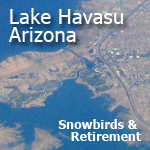
| Lake Havasu City |
| Chloride |
| Dolan Springs |
| Fort Mohave |
| Golden Valley |
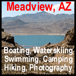
| Meadview |
| White Hills |
| |
Mohave County Arizona Public Lands |
| Bill Williams River National Wildlife Refuge (part) |
| Grand Canyon National Park (part) |
| Grand Canyon–Parashant National Monument |
| Havasu National Wildlife Refuge (part) |
| Lake Mead National Recreation Area (part) |
| Pipe Spring National Monument |
| Arrastra Mountain Wilderness (BLM) (part) |
| Aubrey Peak Wilderness (BLM) |
| Beaver Dam Mountains Wilderness (BLM) (part) |
| Cottonwood Point Wilderness (BLM) |
| Grand Wash Cliffs Wilderness (Grand Canyon–Parashant NM) managed by BLM |
| Havasu Wilderness (Havasu NWR) (part) |
| Kanab Creek Wilderness (Kaibab NF / BLM) (part) |
| Mount Logan Wilderness (Grand Canyon–Parashant NM) managed by BLM |
| Mount Nutt Wilderness (BLM) |
| Mount Tipton Wilderness (BLM) |
| Mount Thumbull Wilderness (Grand Canyon–Parashant NM) managed by BLM |
| Mount Wilson Wilderness (BLM) |
| Paiute Wilderness (partly in Grand Canyon–Parashant NM) managed by BLM |
| Rawhide Mountains Wilderness (BLM) mostly in La Paz County, Arizona |
| Swansea Wilderness (BLM) mostly in La Paz County, Arizona |
| Upper Burro Creek Wilderness (BLM) mostly in Yavapai County, Arizona |
| Wabayuma Peak Wilderness (BLM) |
| Warm Springs Wilderness (BLM) |
| |
Mohave County Arizona Public Airports |
| Bullhead City – Eagle Airpark (A09) |
| Bullhead City – Laughlin-Bullhead International Airport (IFP) |
| Bullhead City – Sun Valley Airport (A20) |
| Colorado City – Colorado City Municipal Airport (AZC) |
| Kingman – Kingman Airport (IGM) |
| Lake Havasu City – Lake Havasu City Airport (HII) |
| Meadview – Pearce Ferry Airport (L25) |
| Peach Springs – Grand Canyon West Airport (1G4) |
| Temple Bar – Temple Bar Airport (U30) |
| |
| |
| |
 |